


Loowit Trail
A trip report on a late-July circumnavigation of Mt. St. Helens.
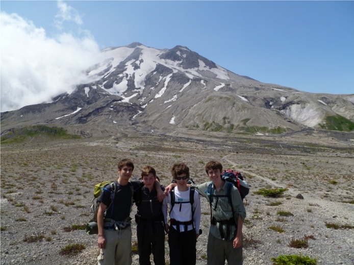
In the grand tradition of last-minute adventures, Dylan Swigget messaged me on 7/24/2012 asking if I wanted to spend the weekend on a backpacking trip. The original plan was to attempt the northern loop of Mt. Rainier, a remote and strenuous 50 mile trip, but rumors of 30% snow cover and tricky navigation were convincing enough that we (Dylan, Lane Aasen, Michael Rosenberger, and I) switched plans to the Loowit Loop trail, a 34 mile circumnavigation of Mount Saint Helens.
Day 0 - 7/26
We left Seattle at around 6:30 pm, delayed by various complications stemming from a certain person’s procrastination on packing, as well as a last-minute trip to REI. Given the time, traffic through Tacoma wasn’t horrible, but progress was slow and by 9:30 we had only just reached Kelso. By then, we realized that we had forgotten to stop and pick up cheese, breakfast, and salami, so we attempted to stop at a market. While we were ultimately successful, Kelso’s geography was confusing and this took much longer than it should have. After leaving Kelso, we promptly managed to miss our exit (loud Mariachi-esque music may have been implicated) - Google rerouted us, but the directions were seriously sub-optimal and involved some sketchy road. We probably should have just turned around and retraced our path back to the correct exit, but we foolishly persevered and arrived at the Lone Fir campground at a bit past midnight.
Day 1 - 7/27
We woke up at around 8:00 the next morning, packed, ate a quick breakfast, and then drove 60 miles to the Windy Ridge trailhead (#216E on our map), on the NE side of the mountain. We started hiking by 12:30, and very quickly reached the junction between trail 216D and 216 - this was very surprising as it only felt like we’d walked two miles, instead of the four we’d covered. Crossing the Plains of Abraham (a reference to the 1759 battle?) was similarly rapid and we stopped for lunch at a waterfall near Pumice Butte. The remaining 5.5 mile section of the day’s hike was uneventfully, if very beautiful, and we arrived in camp at June Lake by 4:45 after a total of 11.6 miles. At dinner, a certain person then realized that he packed neither a spoon nor a bowl, much to everyone’s amussment.
Day 2 - 7/28
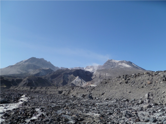
Although we had originally planned to get an early start, Dylan convinced me to push our 5:30 wakeup back until 7:00, which translated to being on the trail by 8:00. The first half of the day’s hike mainly consisted of slowly crossing large boulder fields interspersed with sections of steep forested ridges - we reached the highest elevation of the whole hike (4800’) by noon. As per all of the trip reports I read beforehand, this section of the trail was very dry: we passed the only stream within a mile of starting the day and were nearly out of water by lunch. Fortunately, right after finishing lunch, we found a large snowfield that provided enough snow melt to fill up. The rest of the day’s terrain was very different from the morning, lots of large (15-30 ft) arroyos and lightly forested areas, and by 2:00 the cloud cover had fully burnt off - the last few miles until camp would have been extremely unpleasant if we had fully ran out of water. As a result of some odd advice give to us by another group, we deviated from our original plan by continuing past the campsites on the south side of the south fork of the Toutle river and crossing the river in search of sites on the north bank. Unfortunately, we didn’t find any decent spots, so we reversed the sketchy climb out of the river and crossed back to the south bank, where we found a perfect campsite…
Day 3 - 7/29
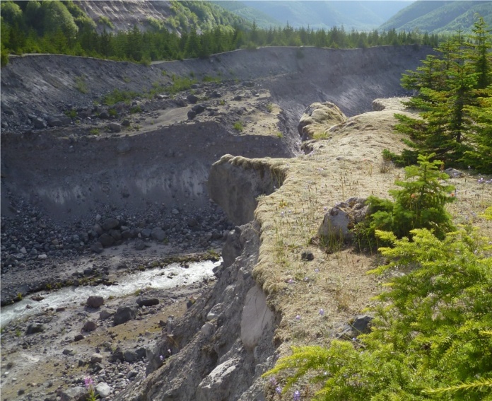
As Dylan thought he had a 3:00 am flight to catch on 7/30, we awoke at 4:30 and Michael, Dylan, and I packed up camp while Lane hiked down to the river to prepare breakfast and pump water. This strategy for a quick morning start worked: we were on the trail by 6:00, just in time to catch the sun rising over the ridge that demarcates the exclusion zone. The climb out of the Toutle river valley gave a sense of how structurally unstable the whole mountain is - it takes just under a mile to climb what is essentially a thousand foot sand dune, carved by a tiny river. Almost immediately after the climb out of the river valley, the trail enters the exclusion zone, the area most devastated by the 1980 eruption. The degree to which the first few miles of the exclusion zone has recovered is impressive: we saw lots of flowers, wild strawberries, groves of small trees, birds, and a large herd of elk. Furthermore, the exclusion zone had the best trail conditions of the whole trip, and as a result we arrived at the car by 12:30.

Resources and Gear
Nice SummitPost trip report that we modeled our trip upon.
We carried two copies of Green Tail Maps’ 364s and one of 364, both of which are available at REI.
At least 3L of water storage is recommended, as the most strenuous section of the hike (June Lake to the Toutle) is very likely to be entirely dry. A filter is definitely recommended, as the entire area is covered in thousands of years’ accumulation of very fine volcanic ash.